
Bowland & Pendle Summits
Burn Moor

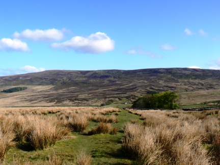
The extensive Burn Moor is the northernmost summit of note in the Forest of Bowland.
| Height (m) | 402 |
|---|---|
| Height (ft) | 1319 |
| Grid Ref: | SD694645 |
| Classification: | None |
| Trig Point: | Yes |
| No. of Visits | 1 |
Burn Moor Gallery: Click on the photos below to enlarge.


More about Burn Moor: If you look south while you are travelling on the A65 between Clapham and Ingleton then you will see a large sweep of moorland some 3-4 miles away. This moor is Burn Moor, the northernmost summit of note in the Forest of Bowland. To the north the moor sweeps down to the area known as the Forest of Mewith which contains the village of Bentham and the small settlement of Keasden. The eastern boundary of the moor is marked by Keasden Beck while to the west and north west it is bounded firstly by Crossdale Beck and then the River Hindburn. It is only to the south that Burn Moor is connected to higher ground - Catlow Hill some two and a half miles away over pathless moorland.
There are two good reasons for visiting Burn Moor - the Great Stone of Fourstones and the view north to the Dales. The former is a huge boulder which was deposited on the otherwise featureless moor by a glacier many thousands of years ago. Due to the name it has been surmised that there were once three other stones nearby which have since been broken up for building materials.
The Great Stone sits just a few minutes walk from the Bentham to Slaidburn road so can easily be visited without any extended walking. At some point in times past steps have been cut into the side of the rock to enable a smooth passage to the top. These steps have worn over time so care still needs to be taken when using them. For centuries it seems to have been a tradition for people to carve their names into the rock, along with more modern graffiti there are apparently examples going back at least 400 years.
While the Great Stone can be visited with very little effort there are two other named rocks in the area that require a little more effort to visit without, it must be said, bringing the same kind of rewards. The first is the Queen of the Fairies Chair. With such a brilliant name I just had to make a detour to see it for myself so I was somewhat disappointed to discover it was a small and fairly innocuous rock that looks vaguely chair shaped. I guess the size makes sense as fairies are not supposed to be particularly large. It did make me wonder though how the stone got its name and how it came to be recorded on OS maps - perhaps there was once a local legend attached to the site.
Another curiously named stone is the Standard on Burn Moor which stands not far from the summit itself. This rectangular shaped rock actually has the word 'standard' carved in the top. The only thing I've been able to find out about it is that it is a boundary stone. Why it is named as it is is a mystery to me.
As mentioned earlier it is worth visiting Burn Moor for its long distance views of the Dales, and in particular Three Peaks country. The view is equally good from both the Standard as well as the nearby trig point which marks the highest point. Ingleborough is particularly well seen as is Gragareth, Whernside, Pen-y-Ghent and Fountains Fell. Catlow Hill cuts off most of Bowland from view although Wolfhole Crag and Ward's Stone can be seen clearly enough.
The downside to Burn Moor is that it is not easy to make a decent circular walk without crossing some rough and wet ground. Particularly bad was the section of Loftshaw Moss just to the west of Gill Beck. It is fair to say this is one of the worst bogs I've come across mainly because while it is reedy it looks crossable until you stand on what looks like a dry section and then just keep on sinking. This bog actually defeated me and so I ended up returning to Slaidburn Lane before turning off up the track called Petersbottom Lane. This leads up to a shooting hut behind which is a thin trod which leads up to the summit - this is probably the easiest way up to the top.


Follow me on ...


