
Llŷn Peninsula
Llŷn Peninsula - Introduction
The Llŷn Peninsula extends approximately 30 miles from Snowdonia into the Irish Sea just to the south west of Anglesey. In 1956 a quarter of the Llŷn Peninsula, including much of the coastline and the highest hills, were designated as an Area of Outstanding Natural Beauty. Today it is one of only 5 such AONB’s to be found in Wales.
Llŷn Peninsula Gallery: Click on the photos below to enlarge.


The peninsula is perhaps best know for its Heritage Coast which is amazingly varied including rocky headlands, steep cliffs, estuaries, dunes and sandy beaches. The tip of Llŷn is Mynydd Mawr, a spectacular place whose steep cliffs overlook Bardsey Island, once a famous place of pilgrimage and supposedly the burial place for 20,000 saints. Almost all the highlights of the Llŷn coast can be visited on the 84 mile long Llŷn Coastal Path, starting from Caernarfon and finishing at Porthmadog.
Walks in the Llŷn Peninsula
 |
 |
 |
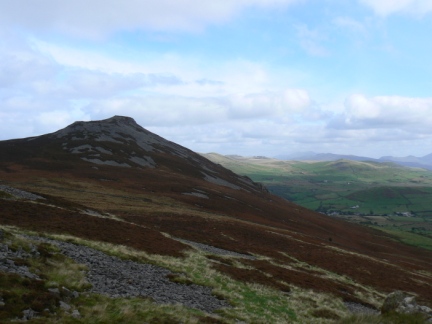
| 13/05/11 - Mynydd Cilan | 01/10/09 - The Rivals | 01/04/12 - Carn Fadryn |
In additions to its fine coastal scenery the Llŷn Peninsula also contains a number of hills, mainly of volcanic origin. The finest of these is Yr Eifl (sometimes known as The Rivals) which in fact has 3 distinct peaks, the highest of which gains an altitude of 564m (1850ft) making it the highest point on the Llŷn Peninsula. The highlight of any walk on to Yr Eifl has to be a visit to the southernmost top known as Tre’r Ceiri after the large Iron Age hill fort whose large ramparts dominate the summit. The fort covers 2.5 hectares and contains the remains of over 150 round stone huts. It is one of the most spectacular ancient monuments in Wales and in some places the ramparts stand almost to their original height of almost 3 metres.
This weather forecast is generated by the Met Office Weather Widget
To the west of Yr Eifl the hills are generally much lower but include a number with enough prominence to be classed as Marilyns including Garn Boduan, Garn Fadryn and Mynydd Rhiw. Garn Fadryn was my first walk in the Llŷn Peninsula and not only does it also feature the remains of an extensive hill fort but its central position on the peninsula makes it an excellent viewpoint.
When, in 2009, we had our first family holiday on the peninsula I’d meant to use it mainly as a base for walking in Snowdonia. As it turned out my knee problems at the time meant that the higher mountains were impractical so I did a few short walks in Llŷn including Yr Eifl. We returned the following two years and whilst I did proceed to spend most of my walking time in Snowdonia I’ve explored a little bit more of Llŷn’s varied coastline, including a family walk on Mynydd Mawr that was abandoned due to strong winds.
Over the coming years I do have ambitions to climb all the Welsh 2000fters but perhaps one day when I have achieved this ambition it would be nice to go back to Llŷn and I really would like to try and complete a walk in the region of Mynydd Mawr at the tip of the peninsula, I’d also like to visit Gyrn Ddu and Bwlch Mawr, the other two summits on the peninsula, apart from Yr Eifl, that are above 500m in height.
Follow me on ...


