West Pennines & Rossendale - Summits
Freeholds Top

Freeholds Top, on the Lancashire / Yorkshire border, is one of only three Marilyns in the West Pennine & Rossendale region.
| Height (m) | 454 |
|---|---|
| Height (ft) | 1535 |
| Grid Ref: | SD906218 |
| Classification: | Marilyn |
| Trig Point: | Yes |
| No. of Visits | 1 |
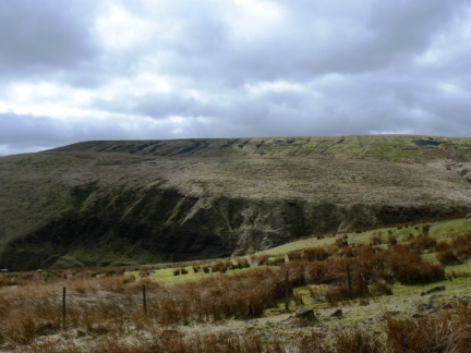
Freeholds Top Gallery: Click on the photos below to enlarge.
More about Freeholds Top: Situated on the main Pennine watershed Freeholds Top is shared between the counties of West Yorkshire and Lancashire and the districts of Calderdale and Rossendale. The summit itself is situated on the Yorkshire / Calderdale side of the 'border'. Along with Hail Storm Hill it is one of two Marilyns to be found within the boundaries of Rossendale and is the only Marilyn in Calderdale.
The hill is named after Freeholds, a farm just north of Shawforth on the Lancashire / Rossendale side of the watershed. The River Spodden, a feeder of the River Roch, rises from its source near the upper western flanks of Freeholds Top. On the eastern side of the watershed the watercourses of Gorpley Clough and Ramsden Clough eventually find their way into the River Calder. Both these latter cloughs contain reservoirs Gorpley Clough Reservoir was completed in 1904 and, the now empty, Ramsden Clough Reservoir even earlier in 1888.
The top of the hill can easily be reached from a choice of routes from Shawforth to the west or from Todmorden or Walsden to the east. The Rossendale Way contours around upper flanks of the hill and bypasses the summit. I visited from the Calderdale side and I would highly recommend that Gorpley Clough is incorporated into the ascent or descent. The wooded clough below the reservoir features a lovely path alongside the stream and a number of modest but attractive waterfalls. In the upper reaches of Ramsden Clough a number of ruined farms, including Coolams, hint at a time when the flanks of Freeholds Top were more heavily populated than they are today.
The summit of Freeholds Top is marked by a concrete trig point that has been painted white. Alongside is a small moorland tarn which has been rendered less attractive than it should be by the presence of a barbed wire fence that runs all the way around it. The views are extensive and include most of the major South and West Pennine tops as well as Pendle Hill, some of the Bowland Fells and the northern and western side of the Peak District.


Follow me on ...


