
West Pennine & Rossendale Walks
Jubilee Tower & Darwen Moor
Date: 31st Aug 2014
Distance: 7.1 miles
Ascent: 1285 feet
Time: 2 hours 45 minutes
With: On my own
Start Grid Ref: SD665215
Walk Summary:
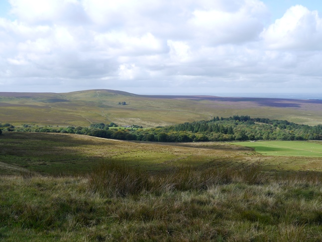
A fantastic walk in the West Pennine Moors visiting the Jubilee Tower above Darwen and Cartridge Hill, the highest point of Darwen Moor.
Route Summary: Ryal Fold - Sunnyhurst Hey Reservoir - Jubilee Tower - Darwen Moor - Duckshaw Clough - Cartridge Hill - Slipper Lowe - Tockholes Plantation - Ryal Fold
Photos: Click on the photos below to enlarge.


Walk Detail: After an enjoyable week exploring the Shropshire Hills I felt the need to visit the Pennines again. As I'd not visited the West Pennine Moors for a while I decided on this walk revisiting the Jubilee Tower on Darwen Moor but, unlike my first visit back in 2010, also including the top of Cartridge Hill, the highest point of Darwen Moor.
I'd originally planned to start the route from the parking area in the woods above the River Roddlesworth at grid reference SD663203 only to find upon arrival that the entrance was locked. Instead I parked further down Tockholes Road by the visitor centre at Ryal Fold.
After crossing a couple of fields I was once again deflected from my planned route due to a footpath closure below Sunnyhurst Hey Reservoir. Instead I took a path above the reservoir that eventually linked up with the path climbing on to Darwen Hill from Sunnyhurst.
It was a beautiful day and as I climbed up towards the Jubilee Tower the views just kept getting better and better. The Jubilee Tower on Darwen Hill is one of my favourite features in the West Pennines. The 85ft high tower was built in 1898 to commemorate Queen Victoria's Diamond Jubilee and also to celebrate victory in a battle with landowners for local people to have access to the moor. The fibre glass dome that had crowned the top of the tower on my previous visit had blown off in a violent storm in November 2010 and has since been replaced by a stainless steel dome in 2012.
The view from the top was absolutely superb. In addition to the sprawl of Blackburn and the surrounding West Pennine Moors the view also included Pendle Hill, the Bowland Fells and further to the north the famous Yorkshire Three Peaks. Due to the sun's alignment the nearby trig point was literally overshadowed by the Jubilee Tower.
From the tower I followed the route of the Witton Weavers Way as it contoured south-east along the moor until I reached Duckshaw Clough from where I took a path crossing over to the western side of the moor. After passing through a gate at grid reference SD670203 I took a thin path on the right hand side of the fence up on to the flat top of Cartridge Hill, the highest point of Darwen Moor. Not quite on the highest point was a superbly built cairn which surprisingly isn't marked on the OS map but which had been visible from as far away as the tower.
Retracing my steps to the gate I descended to Tockholes Road and took a path past the now defunct parking area that I'd originally meant to start from. A wet and slippery track led me down to a fine path that I then followed alongside the River Roddlesworth as far as Upper Roddlesworth Reservoir. The lovely river and woodland scenery provided a fine contrast to the sweeping moorland views from earlier walk though it was slightly marred by the large number of dog walkers. Don't get me wrong, I love dogs, but there seemed to be a larger than usual concentration of the type of dog owner who seem to think it is okay to allow their dogs to jump up at people.
Thoughtless dog owners notwithstanding this was a super walk, in fact I'd say this is the best walk I've done so far in the West Pennines. It is crazy to think that such wonderful countryside is not protected by National Park or even Area of Outstanding Natural Beauty status.


Follow me on ...


