
Yorkshire Dales Walks
High Greygrits & Moudy Mea

Date: 11th July 2010
Distance: 7.2 miles
Ascent: 760 feet
Time: 3 hours 10 minutes
With: Rachel
Start Grid Ref: NY863102
Walk Summary:
A good walk on to two rarely frequented tops where the Yorkshire Dales merges into the North Pennines.
Route Summary: Longband Moss - Long Band - High Greygrits - Aygill Force - Roper Castle - Moudy Mea - Mousegill Bridge - Longband Moss
Pictures:
1. Moudy Mea from Longband Moss

2. Kaber Fell from Long Band

3. High Greygrits above the Tan Hill Inn road
4. The trig point on High Greygrits

5. Rogan's Seat from High Greygrits

6. The small quarry near the summit of High Greygrits

7. An extremely weathered patch of limestone pavement

8. Aygill Force

9. The shooting hut near Aygill Force

10. Having fun with my poncho

11. The wind was so strong it nearly blew the poncho clean off

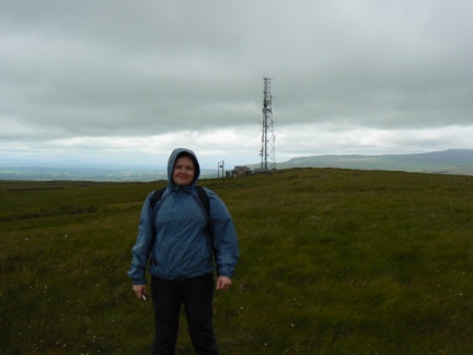
12. Rachel on the top of Moudy Mea
13. Looking back up to Moudy Mea

14. Looking across to the North Pennines

15. The Eden Valley

Walk Detail: My previous attempt to go on this walk had ended in failure when my car died on me on the A1 (see my blog). Thankfully this time the (new) car made it without any problems.
As we journeyed up the A1 the sun was out and the outside temperature reading was a very pleasant 18°c. By the time we had crossed the A66 to South Stainmore the the temperature had dropped to 10°c and it had started raining. It was also rather windy.
Luckily we only had a few short showers early on though the wind was stayed fairly strong for the whole walk. The walk itself was fairly easy and apart from a small section was mostly on good tracks with two sections along the quiet but very scenic road from South Stainmore to the famous Tan Hill Inn. High Greygrits was probably the more interesting of the two hill tops we visited. As well as an old stone trig point the summit area also featured two small abandoned quarries, the larger of which provided shelter for an early lunch.
A shooters track took us all the way from High Greygrits to the attractive waterfall Aygill Force. Presumably because of the dry spring and summer the waterfall itself was more of a trickle. From Aygill Force we headed off across rougher ground in search of Roper Castle the name given to the site of an old Roman Signal Station. I'm fairly sure I found the site but there is nothing much to see apart from a slightly raised and reedy section of ground.
The summit area of Moudy Mea was surprisingly grassy. Apart from the radio transmitter there was nothing much else to see though there was a good view north to the North Pennines. As the previous few days had been hot and muggy and there was the possibility of rain I had taken my poncho on a walk for only the second time. Unfortunately I hadn't taken the wind into account which made it completely impractical attire.
It was however the source of fairly constant amusement and on the top of Moudy Mea I decided to unshackle the poncho from the restraining presence of my rucksack and almost straight away it was almost completely blown off over my head. I gambolled around a bit to allow Rachel to take some pictures before finally stowing it away in my backpack.
This was a good little walk which we both enjoyed despite the buffeting from the wind.


Follow me on ...


